
Haryana Government Announces Full Scholarships for SC and OBC Students
Haryana Chief Minister Nayab Saini has made a historic announcement that brings hope to thousands of students across the state. All students from Scheduled Castes (SC) and Other Backward Classes (OBC) pursuing medical and engineering courses in government colleges anywhere in India will now receive full scholarships. To make the process easier, the government will soon launch a special online portal where eligible students can apply and track their applications easily. This step aims to remove financial hurdles and ensure that no deserving student is left behind due to lack of resources.
Tributes to Mahatma Jyotiba Phule and Jallianwala Bagh Martyrs
On the occasion of Baisakhi, CM Saini also paid tribute to Mahatma Jyotiba Phule, the great social reformer, thinker, and philosopher who dedicated his life to fighting caste discrimination and promoting education among the underprivileged. He also remembered the martyrs of the Jallianwala Bagh massacre, honoring their supreme sacrifice for the country.
Income Limit for Creamy Layer Increased
In a significant move for the OBC community, the Chief Minister announced that the income limit for the creamy layer has been increased from ₹6 lakh to ₹8 lakh per year. This change will allow more students from backward classes to benefit from government reservations and welfare schemes.
Affordable Education Loans for Economically Weaker Students
Further supporting education, the Haryana government is offering affordable education loans to economically weaker families. If you come from a family that makes up to ₹3 lakh a year, you can snag loans of up to ₹15 lakh for studying in India and as much as ₹20 lakh for studying overseas, all at a super low interest rate of just 4%! This is such a great chance for so many students to think bigger and go after their dreams without stressing too much about money.
Haryana Leads in Farmer Welfare
The Chief Minister also spoke about Haryana’s leadership in farmer welfare. Haryana is the first state in the country to ensure 100% procurement of crops at Minimum Support Price (MSP), providing farmers with much-needed income security.
Affordable Gas Cylinders Under ‘Har Ghar Grihini Yojana’
Apart from this, under the 'Har Ghar Grihini Yojana', 17 lakh poor families in Haryana are getting LPG cylinders at a heavily subsidized rate of just ₹500 per month, easing the cost of living for many households.
CM’s Appeal to Educate Every Child
CM Saini urged parents to prioritize their children’s education, emphasizing that educating every child is the true way to honor the legacy of Mahatma Phule. He said that education is the most powerful weapon to eliminate poverty and bring social change. He appealed to everyone to make sure that no child is deprived of education, as an educated society is the foundation of a strong nation.
Grand Event to Celebrate Mahatma Phule’s Vision
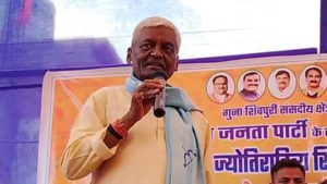
The announcements were made during a grand event organized by the All India Saini Seva Samaj on the occasion of Mahatma Jyotiba Phule’s birth anniversary. The event was held at A Dot Banquet Hall near Ambience Mall in Gurgaon. Several senior leaders and dignitaries attended, including Keshav Prasad Maurya, Deputy Chief Minister of Uttar Pradesh; Samrat Choudhary, Deputy Chief Minister of Bihar; Chhagan Bhujbal, former Deputy Chief Minister of Maharashtra; Upendra Kushwaha, Member of Parliament; and social activist Kalpana Saini. They all expressed their support for education, equality, and empowerment, resonating with the vision of Mahatma Phule.
A Vision for a Progressive and Educated Society
Haryana's recent initiatives reflect a strong vision to build a new India where education is accessible to all, regardless of their background. The state’s focus on scholarships, affordable loans, farmer support, and women’s welfare through subsidized gas cylinders shows a multi-dimensional approach to uplift marginalized communities. CM Saini’s vision is clear: a progressive society can only be achieved through education, empowerment, and economic independence. As he concluded, he reminded everyone that when every child gets educated and every family progresses, only then will India truly move toward a brighter future.